A partnership between Backroad Mapbooks and the province is bringing 'geo-caching' to 18 of B.C.'s popular recreation sites and trails.
In recognition of their 20th anniversary, Backroad Mapbooks has developed a GeoTour program to celebrate and promote Canada's beautiful backcountry.
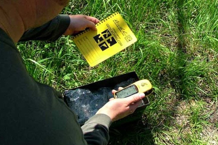
The GeoTour is based on the popular recreation activity of 'geo-caching'—a modern-day treasure hunt that uses GPS co-ordinates to locate containers (called caches) and collect 'treasures' in a specific area or along a specific route.
Backroad Mapbooks has teamed up with the Recreation Sites and Trails BC to launch phase one of the tour, which includes using 18 recreation sites and trails throughout the province as 'geo-caching' locations.
Begbie Falls near Revelstoke, Buchanan Lookout recreation site near Nelson and Monroe Lake near Cranbrook are the three Kootenay Rockies sites.
A total of three cache containers have been hidden in each of B.C.'s six regions, plus two bonus caches for a total of 20 caches. The caches are named and hidden under three specific themes: on the trail, on the road and on the water.
To find out more about Phase One of the GeoTour including instructions and which recreation sites and trails are taking part visit:
http://www.geocaching.com/adventures/geotours/backroadmapbooks.
The object of the tour is to find all the hidden caches and 'swap' and collect items inside the containers. As you collect different 'treasures' under each theme, you then place the corresponding stickers on a sticker collection page. Once you collect all stickers in each region you can send them in to receive the Backroad Mapbooks regional geocoin.
Learn more about geo-caching: http://www.geocaching.com/.