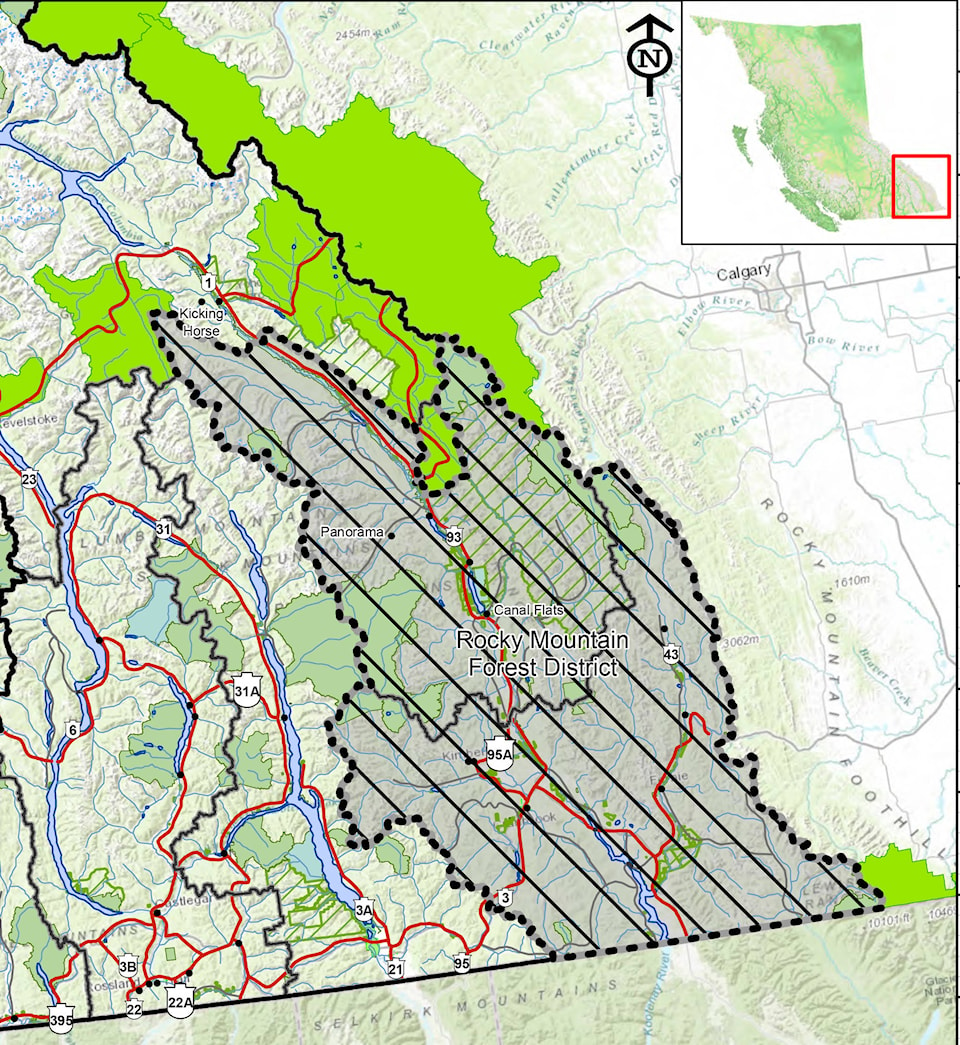
In the interest of public safety, effective at noon Pacific Time on Saturday, Sept. 2, 2017, all Crown land within the Rocky Mountain Natural Resource District is closed to public access due to the extreme fire danger rating, the number of unprecedented aggressive wildfires throughout the region and moderate winds forecasted over the next few days.
NEW: Backcountry closed in the Rocky Mountain Forest District. https://t.co/7detES01Hp @BCGovFireInfo #BCWildfire
— BC Government News (@BCGovNews) September 1, 2017
The area stretches from the Aberta border west to Yahk and from the US border north almost to Kicking Horse. It includes Cranbrook, Kimberley, Panorama, Invermere, the Purcell Wilderness and Canal Flats.
The area restriction order means that a person must not remain in or enter the restricted area without the prior written authorization of an official designated for the purposes of the Wildfire Act, unless the person enters the area in the course of:
• travelling to or from his or her residence, that is not under an evacuation order;
• using a highway as defined in the Transportation Act;
• travelling as a person acting in an official capacity;
• travelling for the purpose of supporting wildfire suppression activities.
A map of the affected area is available online here.